Is it really possible that a whole month has passed since we flew into Guatemala City? It doesn't seem possible, but it is. This week we had a great adventure on Monday. President and Sister Burke drove us, the Wilsons and the Olsens to the Relief Map which is a mostly to scale map of Guatemala including parts of other countries that border on it. The scale is supposed to be pretty accurate horizontally, but the vertical scale is about two times higher than in reality, so the mountains look much steeper and higher than they actually are. It was pouring down rain all the time we were there, so the rivers and oceans were pretty realistic!
The sign in he lower right corner shows the Usumacinto River which is the one we boated down on our tour last fall. It divides part of Mexico from Guatemala and is where we crossed the border. The blue part is Guatemala and the white is Mexico.
Here we are in the highlands. About the center of this shot is Quetzaltenango where Gary and Dena served their first mission in Guatemala and where we are going to travel in the first week of the temple closure in early July. This is the location of the second temple in Guatemala, and we will be able to attend it when we visit!
Guatemala City is somewhere in the center of this shot. You can see that it is in the highlands. That is why the weather is so beautiful here. It tends to stay right around 70 degrees all the time, even when it rains. They call it the land of eternal spring. The structure in the back of the picture is one of the two towers we climbed to get a better view of the map.
This is the area where we are going during the second week of the temple closure. It is Rio Dulce which runs down to the Caribbean. You can see a piece of the Caribbean on the far right just a little above center and the river running into it.
In the center of this shot is a blue lake. That is Lake Atitlan, said to be the most beautiful place in Guatemala and thought to be a candidate for the Waters of Mormon. We were also there last fall. You can also see the line of volcanoes running down the left side of the picture.
The green tent is where workers are redoing some of the map. It is pretty old and needs new paint occasionally. It is in the general area of Polachic where the sweet indigenous Kecchi live who we have told about coming to the temple. The yellow building in the background is a museum, but all it has are pictures of the areas of Guatemala, so we didn't take any photos.
These beautiful hydrangeas were outside the museum. Reminded Dorine of her backyard in Pacific!
From there we went to Mercado Centro where we did some fun shopping. There are three levels of merchandise. All of it is in booths where people bring their wares to sell. The first floor was textiles, paintings, clothing, etc. The middle floor was food like the picture shown here, the flowers shown below and places to eat.
The bottom level had more clothing and lots of novelties as well as T-shirts. We found some fun items that we bought.
Outside the rain had stopped, and the pigeons came in force to enjoy the nice day.
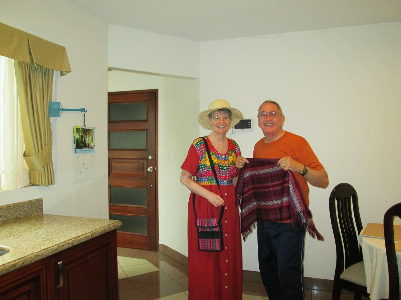
Back home we took pictures of us with our bounty.
Since you can't see the words on Gary's T-shirt, we took another shot.
For those who don't speak Spanish, it translates: "Handsome in danger of extinction."
That afternoon Gary had a "Big Mac Attack", so we had to walk down and have a visit with Ronald.


Good blog. I do enjoy your page. Missing you, but glad you are able to do the mission.
ReplyDeleteGuatemala is a lot larger than I thought it was. The map is very interesting.
ReplyDelete